File:Map-AllianceEnlarged.jpg
Jump to navigation
Jump to search
Size of this preview: 779 × 600 pixels. Other resolutions: 2,560 × 1,970 pixels | 3,000 × 2,309 pixels.
Original file (3,000 × 2,309 pixels, file size: 4.15 MB, MIME type: image/jpeg)
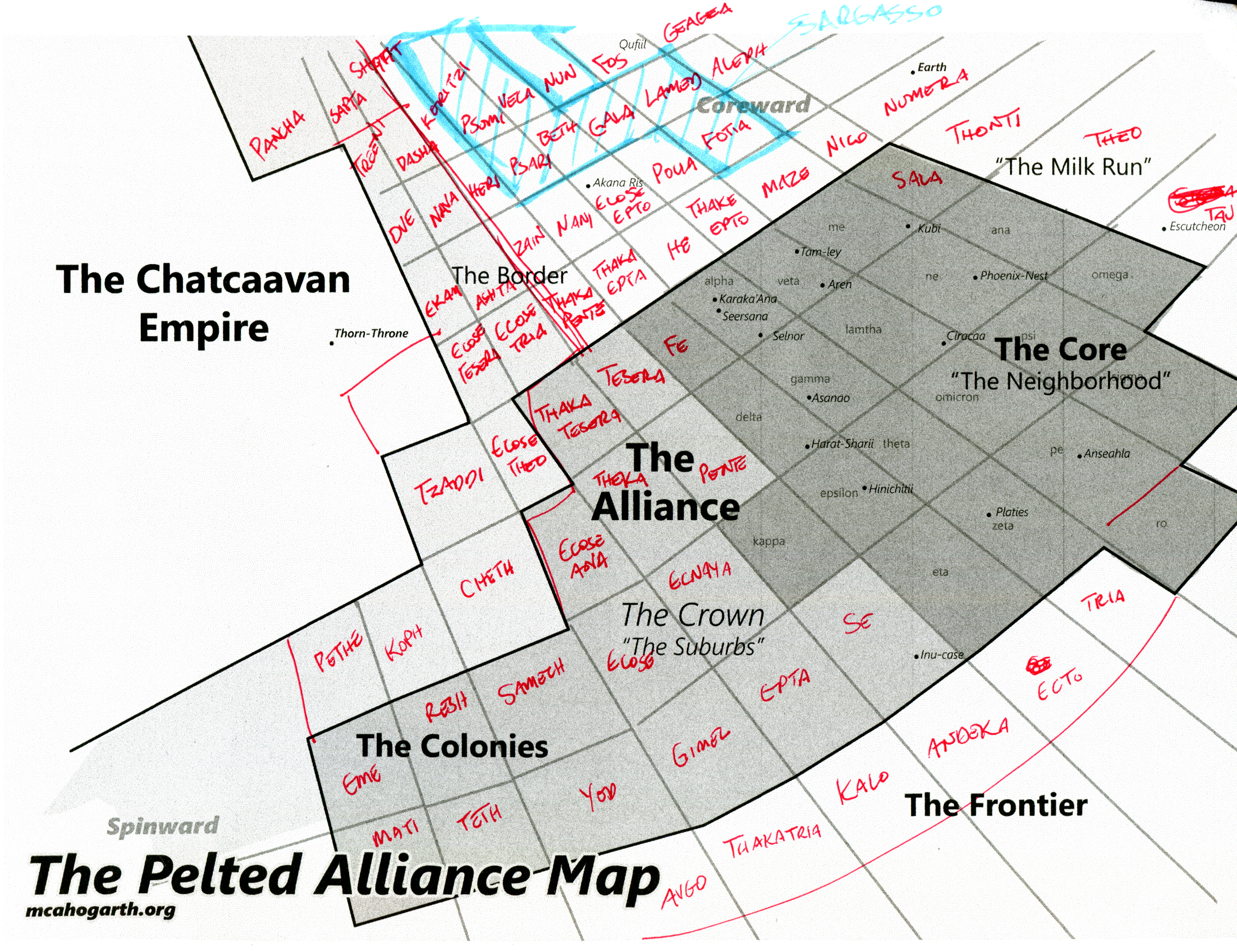
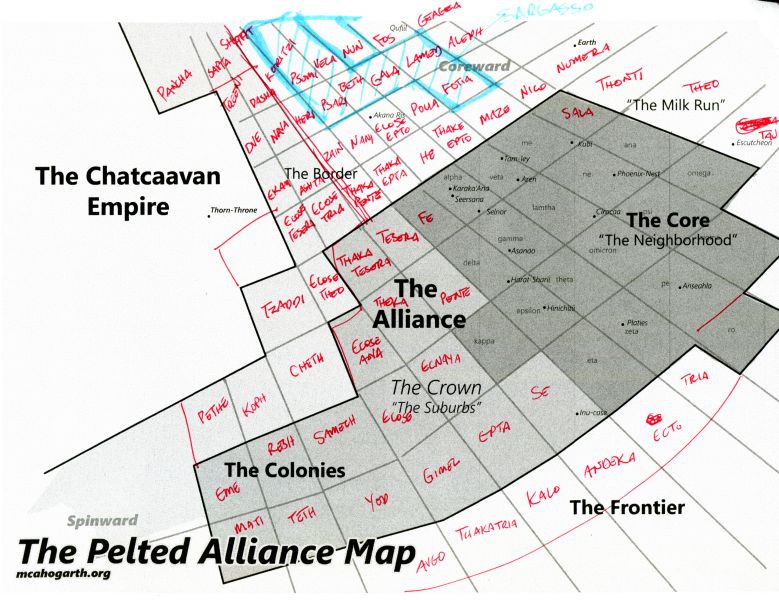
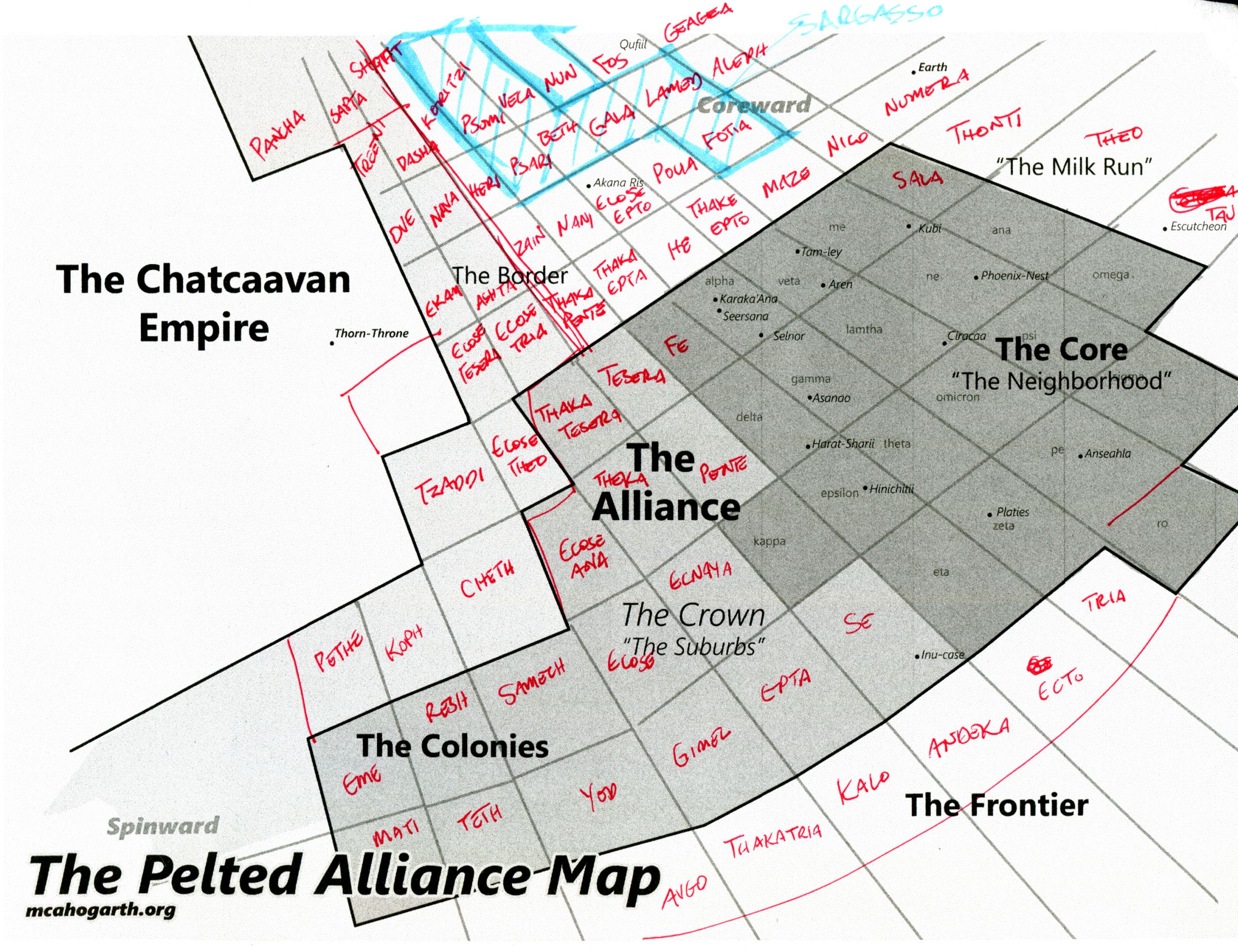
Summary
The Alliance map with the border and distant sectors labeled.
File history
Click on a date/time to view the file as it appeared at that time.
| Date/Time | Thumbnail | Dimensions | User | Comment | |
|---|---|---|---|---|---|
| current | 18:49, 11 June 2020 | | 3,000 × 2,309 (4.15 MB) | Jaguar (talk | contribs) | The Alliance map with the border and distant sectors labeled. |
You cannot overwrite this file.
File usage
The following 2 pages use this file: